Examining New York City’s
Inhospitable East River
How revitalizing and rewilding the East River waterfront could alleviate the contaminated waters and promote biodiversity and usage.
New York City’s sewer system was first created in 1849, today the systems contains 6,600 miles of pipes and mains. With such an outdated system each time there is significant rainfall the sewer pipes overflow and release wastewater directly into the waterways. This issue is becoming increasingly prominent with our implications of climate change and subsequent ecological responses. Following the impact of Hurricane Sandy in 2012 it became clear how vulnerable our waterfront facilities and infrastructure is to flooding. This pushed the city to create 11 Long Term Control Plans (LTCP) to help relieve sewage overflows in all 5 boroughs.

Sandy Inundation Zone and Floodplains
New York currently has 100 square miles in the 100-year coastal floodplain. By 2050, this is projected to increase to 150 square miles due to sea level rise.
There is a 1 in 29 yr event that the NYC 100 year flood could rise 5.9’ above high tide.
5.2 billion gallons of sewage spilled in New York after Hurricane Sandy.
Highest storm tide ever recorded in New York, reaching nearly 14 feet in height, about 9 feet from storm surge.
Stronger storms and rising seas will increase flooding, a surge like Sandy could occur once every 23 years as opposed to once every 400.
East River Top 5 Combined Sewer Overflow Outfalls
Sewer System
About 70% of the city’s sewershed area is combined, carrying both stormwater runoff and wastewater.
14 Sewage treatment plants were strategically placed near water and in low-lying areas, for the advantages of gravity, helping the pipes and the accessibility to the receiving waters for treated sewage discharge. They handle 1.3 billion gallons of wastewater daily.
There are 460 outfalls located around the coast of the city. Millions of gallons of sewage is released into New York’s waterways each year.
Waterfront Information
Since the city of New York is surrounded by water, there are many publicly owned waterfront and public access points being affected by climate change inhanced issues and the city’s combined sewer system.
NYC Public Beaches Monthly Visitors
Enterococci in the East River
NYC Public Beaches Warnings/Closures
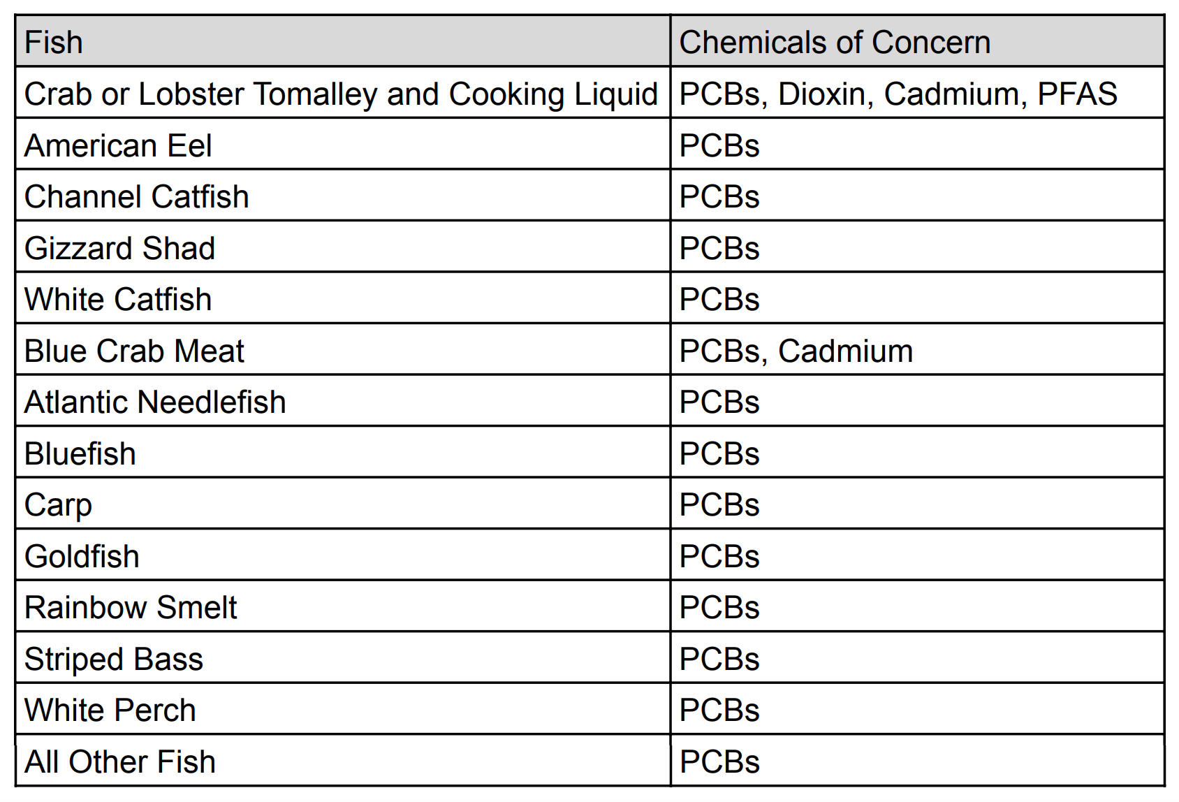
East River Fish Consumption Advisories
Recommendation
Our research shows the identification and extent of the East River's pollution and how the waterfront in NYC is used/isn't used. Our recommendation for how the East River waterfront could become more usable/attractive to the public would be through the softening and re-wilding of the shoreline. This would mitigate the runoff and pollution and provide a stronger foundation for the regeneration of the biodiversity of NYC. The communities near the waterfronts would also benefit from the restoration of local waterfront accessibility.
New York City Native Wetland Species

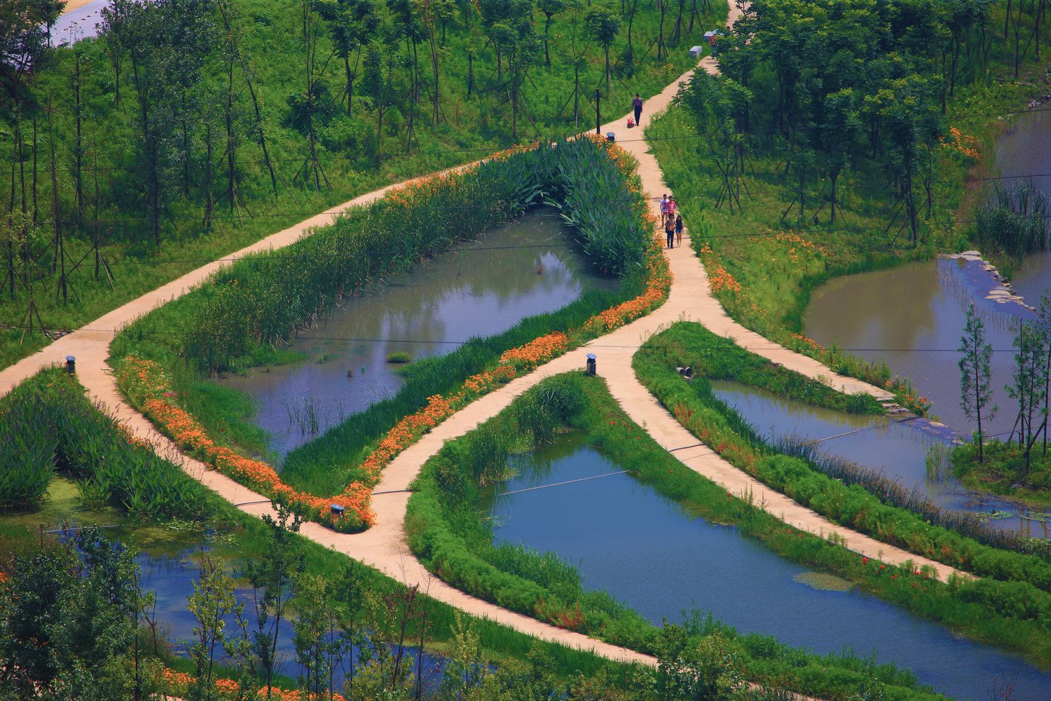
Minghu Wetland Park, Turenscape, Lupanshui, China

Site Plan
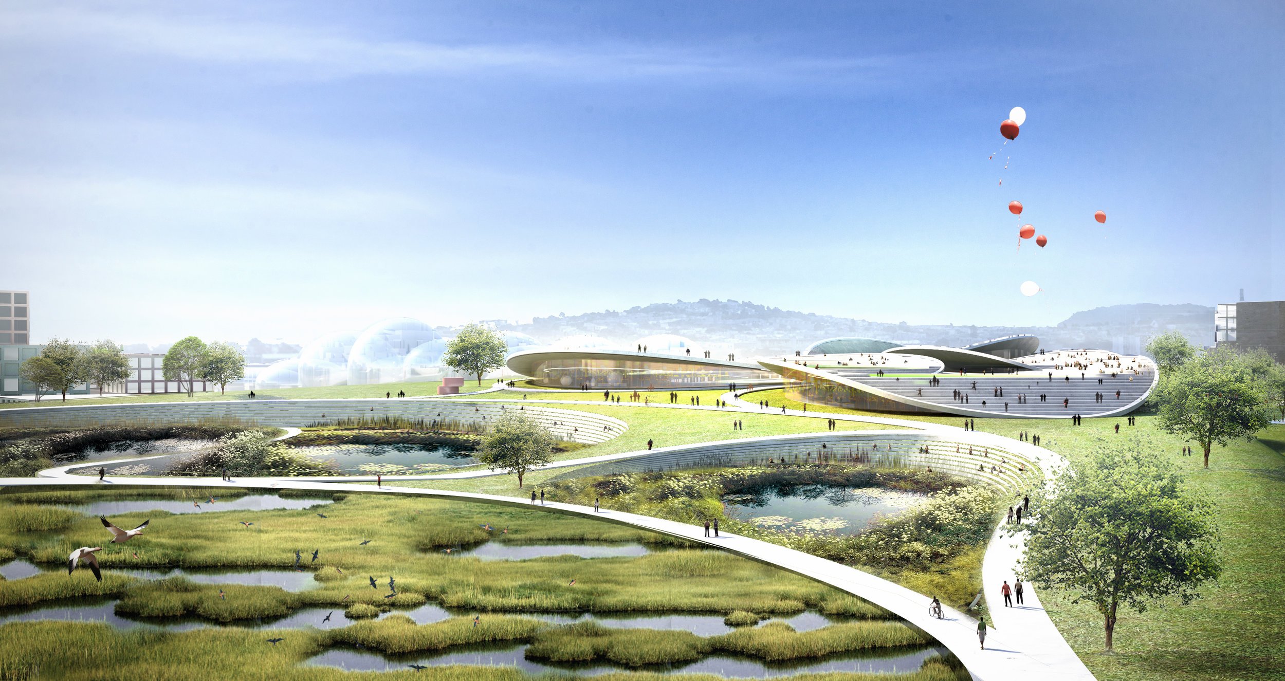
Islais Hyper-Creek, BIG+ONE+Sherwood, San Francisco, California

Islais Creek Toolkit